
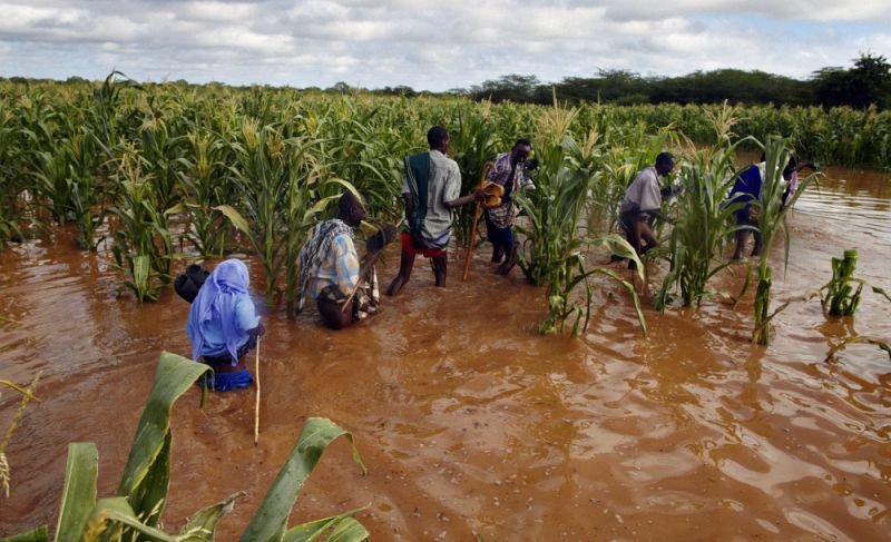
- Across East Africa, weather experts observe that El Niño has delayed but the phenomenon is still coming.
- Dry spells typical of El Niño spells.
- Authorities maintain high caution.
The East Africa El Nino rains that were expected to begin in October have not started even as the month comes to a close, raising questions. Several national meteorological authorities have issued official explanations as to why the feared heavy downpour has been delayed.
“The delayed onset of the October–December 2026 El Niño rains in East Africa is caused by low-pressure systems over the northern Indian Ocean and local interactions with the Madden-Julian Oscillation (MJO) and the Indian Ocean Dipole (IOD),” explains the Kenya Meteorological Department (KMD).
The authority also cites, low pressure systems developing over the northern Indian Ocean as another reason.
In the explanation, KMD explained that the ensuing low pressure systems have temporarily halted the normal southward migration of the Intertropical Convergence Zone (ITCZ) and it is this interruption of the ITCZ, which usually brings short rains to the region, that has caused a stay of the El Nino in East Africa.
Generally speaking, it is these two phenomena, the interruption of the ITCZ by changes of ocean atmosphere dynamics, as well as the shifting MJO pulses, that have altered the previously announced early season heavy downpour.
The EAC has been on high alert following warnings of the forecasted strong El Niño that is expected to bring heavy rainfall and flooding across the eastern Horn of Africa.
However, there are reports of the onset of deludge in various areas. For example, the authorities in Kenya say, while the season has had a slow start in October, some areas such as Nyeri have experienced significant rainfall up to the highs of 147.8 mm “…with heavy downpours expected to peak around November,” the authority warns.
On the contrary, while the above mentioned areas are reported to have had the said heavy downpour, elsewhere in the country, dry weather spells have persisted.
Reached for comments, Hannah Kimani, Director for Public Weather Services at Kenya Meteorological Service Authority (KMSA) acknowledged that the causes of the delayed rains, are in fact the same reasons why much of the region is experiencing hot-dry spells.
According to the expert, since the Indian Ocean is the key source of moisture for rainfall, having lacked the necessary conditions pre-requiste to sustain the expected rains over parts of central and eastern Kenya, the end result is dry spells in these areas.
That been said, weather authorities in Kenya say they are “…monitoring a tropical storm that could influence rainfall patterns in the coming days.”
“Its impact will depend on the direction in which it moves, meaning it could either support rainfall or divert weather systems away from areas expecting rain,” Met told media in the country.
Is this ‘tropical storm’ due to bring about the expected El Niño? The authorities say no. Met maintains that, while rainfall could occur in pockets of the country, it remains unsure as to whether the developing storm will actually bring about enough rain to end the prevailing dry spell.
Meanwhile, in neighboring Tanzania, the Tanzania Meteorological Authority (TMA) maintains it’s initial warning that the short rains seasons, locally known as Vuli, which occur between October and December, will be strongly affected by El Niño.
Influenced by El Niño, “…the season is expected to have above-normal rainfall that will persist and intensify into December and extend through to January 2027,” TMA cautions.
The authority cites the northern coast, northeastern highlands, Lake Victoria basin, and northern Kigoma Region as the areas that will be mostly affected.
Generally speaking, according to the UN agency OCHA, El Niño is characterized by these two contrasting effects on Eastern Africa’s climate.
On one hand you have drier-than-normal conditions in northern and western areas during the June to September (JJAS) season, and wetter-than-normal conditions in eastern and southern areas during the October to December (OND) season.
Also Read: Climate forum in Tanzania passes 15 decisions on ocean governance
Is El Niño still coming?
Despite the delay and ongoing hot-dry spells, the World Meteorological Organization (WMO) and most all regional climate centers reaffirm that there is “…a nearly 100% chance that the event (El Niño) will continue into early next year.)
UN agencies maintain their earlier issued warnings based on the forecasts of “…a high likelihood of above-average rainfall during the October to December period across much of equatorial Eastern Africa, particularly in southern Ethiopia, Somalia and north-eastern Kenya.”
“Combined with a forecast positive IOD, this increases the risk of flooding, with potential consequences including displacement, infrastructure damage, crop and livestock losses, and outbreaks of waterborne diseases,” the WMO warns.
Back in September, the WMO citrd a new seasonal climate outlook released by the IGAD Climate Prediction and Applications Centre (ICPAC), together with National Meteorological and Hydrological Services (NMHSs) in the region, in which it warned that, there is an increased likelihood of wetter-than-normal conditions in the last quarter of 2026 in the region.
In a media report released just this week, UNDP explains that El Niño”…does not arrive here as a single hazard. It arrives as a whiplash: drought, then deluge, and in some places both at once.”
Titled “From Drought to Deluge: Preparing Eastern Africa for El Niño’s Double Hit” the report warns, it is important to understand that “…the drought does not end when the rain begins. It decides how much damage the rain will do.”
The expected economic impact is life draining, to say the least: IGAD’s latest regional analysis says 40.3 million people are facing high levels of acute food insecurity across six member states, that figure is nearly three times the 13.9 million recorded in 2016.
“In Kenya’s arid and semi-arid counties alone, the number has climbed to about 4.1 million, 46 percent above the 2025 peak,” it warns.
The UNDP report concludes with a sombre reminder that the El Niño analogue years bare a key lesson; “Kenya’s 1997/98 El Niño floods were followed by the 1998 to 2000 La Niña drought, and together that sequence cost the country an estimated 290 billion shillings, about 14 percent of GDP.”
Then it goes on to assert that while there is no forecast that the same will happen in 2027, however it points out that the pattern is familiar “…in Eastern Africa, the end of one hazard is often the start of the next.”

Leave a Reply